Please be aware when registering, all times are in the Eastern Time Zone. Even for free events, you will need to click the "Proceed to Checkout" button and "Submit Order"
to complete your registration. If you do not receive an automated confirmation email, or if you have any questions about registration, please email
onlineseminars@saa.org.
Registration Closed!
LiDAR Recordation Techniques for Cultural Resources: Selecting an Application for Your Project
When: May 25, 2021 2:00-4:00 PM ET
Duration: 2 hours
Certification: RPA-certified
Pricing
Individual Registration: $99 for SAA members; $149 for non-members
Group Registration: $139 for SAA members; $189 for non-members
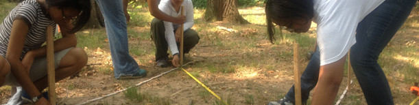
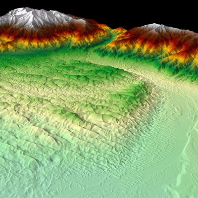
C. Cliff Creger and Beth P. Smith have been utilizing LiDAR capture and recordation methods since 2008 in situations spanning across the spread of the Nevada Department of Transportation’s cultural resources work. They have used and presented LiDAR recordings of petroglyphs, ruins, haunted hotels, antelope traps, excavated caves, Mastodon teeth, and lithic tools.
This presentation reviews and illustrates the wide application spectrum of LiDAR technologies for use in cultural resources projects. Depending on the feature or object to be scanned in the field, aerial, terrestrial and drone data each deliver different final products. The instructors will discuss methods for selecting a project-specific approach, the setup of the recordation event, and how to achieve the visualization outcome desired for the project. The lecture will include case studies from cultural resource projects. The instructors will discuss the steps to consider, including how to “look” at the object to be recorded in three dimensions and estimate how to perform the scan to achieve and produce the final 3D object. They will review the use of engineering-grade LiDAR, iPhone LiDAR, and photogrammetry-based LiDAR, as well as some common mistakes to avoid in collecting and processing 3D data.
- Develop methods for selecting a project-specific approach
- Explain the setup of the recordation event
- Outline how to achieve the visualization outcome desired for the project